

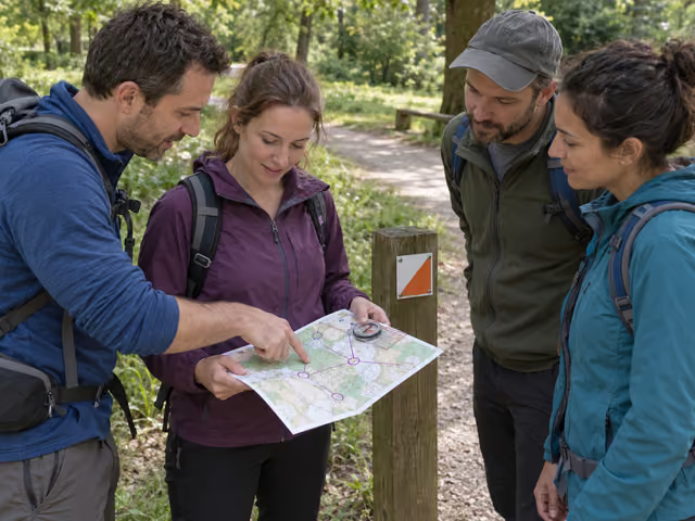
The quick version
Choose an open beginner course with physical controls and a printable map. Agree on the control order, finish location and return deadline. Orient the map at the start, choose a legal path to the first control, and walk there together. Check its identity and record the required letter or symbol. Repeat in order, then return, count everyone and check in with your named contact. Completion is the result; there is no race winner.
Saved on this device only — clearing your browser's cache or site data removes them (no account backup).
Choose a course you can actually use
Find a permanent course through a local orienteering club or park. Select its beginner course with controls on or close to clear paths and with instructions for recording visits on paper. Check current access, opening hours, map availability, maintenance notices, permission for your group size and any fees or booking requirements. A directory listing does not confirm that today's controls are intact. QR-only or virtual courses need a different phone-based format.
Use the provider's latest published map and instructions, keeping its printed version or date with you. Print at the stated page size and scale. Choose a route whose distance, climb, surface and crossings suit everyone, and check the weather and remaining daylight. Confirm the exact start before leaving home; the car park and course start may be different places. A map never grants access across private land or closed areas.
All 2–8 people participate in one group; the host is one of them. There is no extra player waiting at the finish. Ask everyone to agree to the route and walking pace. If nobody can understand the map and provider's beginner instructions at the start, take a club's beginner instruction instead of setting out on an unfamiliar course.
Bring the map and make a return plan
Each person needs one legible paper course map, water, shoes that grip the terrain, clothing for the conditions and a whistle. The group needs one magnetic compass, one pencil, one copy of the provider's control descriptions and recording sheet, a timepiece and a charged phone for emergencies. If there is no recording sheet, make a paper list with one row per control in the chosen order and space for its proof letter or symbol. Descriptions may already be printed on the map. The installed controls belong to the provider; do not bring or hide new markers.
Before starting, name a contact who is not on the walk and tell them the course, participants, finish/check-in location and latest return time. Agree what they should do if you fail to check in, following the site's emergency guidance. This contact is not included in the 2–8 participants. Choose a turnaround time early enough to return by that deadline; a park closing time is a limit, not a target. Mark permitted exits and the provider's emergency instructions. Mobile reception and assistance are not guaranteed.
Pick a navigator to propose the next leg and a recorder to log visits; with two people, take one role each. Others follow on their own maps and can question a route. Everyone stays together. The phone is carried for safety, not used to direct ordinary navigation, so this guide still requires a phone.
Read the first leg before you move
Locate yourself at the actual start. A standard course overlay uses a triangle for the start, circles for controls and a double circle for the finish; permanent maps may combine start and finish or use a separate numbered list. Read this map's legend and instructions. The control's sequence number and its marker identity can differ: the first stop might be marker 31. Use the description sheet to learn both where to look and what identity to expect.
Orient the paper so its paths and landmarks line up with what you see. When the map identifies magnetic-north lines, turn the map until those lines point the same way as the compass's north needle. Follow the provider's instructions if its north reference differs or is unclear. Keep your thumb beside your current position and move it when you confirm a new landmark.
Choose a legal path to the next control, using recognizable junctions or buildings to check progress. The straight line between control circles shows their sequence; it is not an instruction to cross fences, water or vegetation directly. Before the first step, the navigator should point to the first control and say which path and visible junction the group will use to get there.
Navigate, verify and record
Walk one leg together
Move at the agreed walking pace, keeping every participant with the group. Stop somewhere safe to read the map at junctions. Confirm landmarks as you pass them rather than following another group; their course may differ from yours. Anyone can ask for a pause, rest or return.
Check the actual control
Use the marked location and description to identify the feature. Compare the post or plaque identity with the one required for this leg. Read and write the proof letter, symbol or answer the provider requests in the corresponding row. A nearby marker with another identity is not your control. Do not move, mark or damage controls.
Choose the next leg
Confirm your current position, look at the next required control and agree on a route. Roles may change at a control if someone wants a turn. There are no scored turns, guessed directions or points for speed. Repeat until all chosen controls have been visited in order or it is time to return.
Finish and account for everyone
After the last control, navigate to the published finish, which may be the start. The host counts every participant, checks the recording sheet and tells the named contact that the whole group is back. Do this even if you stopped early. If the site requires its own check-in, complete that too before leaving.
Say: 'The map tells us where the checkpoints are. We choose the paths between them. Let's point to our first control and the junction we expect to see before it.' This is a briefing, not a clue supplied by the control.
Complete the course; do not invent a score
The group completes the chosen course when it visits every required control in the stated order, records the required proof and returns together to the finish. Check answers against the provider's key if one is available. Otherwise the record documents your visits but is not independently verified. There is no winner, ranking, tie or fastest-time prize in this format.
A missed, wrong or unverified control means the course is incomplete. Correct an error only if the group can safely revisit the required control and resume the remaining order before the return deadline. Otherwise write down what happened and return. An early return is a valid end to the outing; completing a course never overrides the return plan. Compare route choices afterward rather than penalizing the person who made a mistake.
Handle uncertainty before it grows
If landmarks stop matching, stop together. Identify the last place you were sure of and check the features around you against the map. Retrace a known safe path only if you can identify it confidently. If you cannot establish your position or need help, follow the site's emergency procedure and seek assistance; do not wander farther hoping to find a control. Use emergency navigation aids or your phone when needed and record that the course was assisted.
A missing marker may reflect a navigation error, damage or a map change. Recheck the location and description without crossing a closure or extending the agreed return plan. Record an unresolved control as unverified and report it to the provider afterward. Do not make up a letter or treat a matching-looking tree as proof. If people disagree about a route, pause and choose a legal option everyone can manage, or return.
Keep discussion open so the most confident map reader does not make everyone else a passenger. Let people rest, step aside for other path users and leave signs and vegetation intact. Running, solo departures and splitting up to search are outside this main format. Walking still requires terrain-specific preparation; it is not a seated or universally accessible activity.
At a club event, use the event's rules
If you choose a staffed event instead, ask the organizer which beginner course and group entries are allowed. Follow its registration, start procedure, control order, punching method and course-close time. Groups may have stricter size limits than this guide. Timed line courses generally rank valid completions by elapsed time; score events use their own point and late-return rules.
Return and report to the finish even if you did not complete the course. Electronic events may require both a finish punch and download to show you are back. The walking format, paper proof and variations here do not replace those procedures or establish a sanctioned event result.
Already know the game?
Ideas & Twists
Choose a variation together before you start.
Orienteering · See main rules
House format for 4–8Two groups, one route debrief
With the provider's permission, divide into exactly two buddy groups: 4 becomes 2+2, 5 becomes 2+3, 6 becomes 3+3, 7 becomes 3+4 and 8 becomes 4+4. Each group needs its own compass, recording sheet, pencil, timepiece and charged emergency phone, plus each participant's main-format kit. Each must have someone who can use the map and emergency instructions. Agree the same course, finish and deadline, tell the outside contact both rosters, and let each group plan independently. Stay together within each group; this is a comparison exercise, not a chase or race. At the finish each group reports its entire roster back; the host confirms all participants and closes the check-in. Both may complete the course, neither wins, and partial or assisted attempts stay labeled. Compare chosen paths on the maps afterward. For 2–3 people use the main single group.
Orienteering · See main rules
House practice formatThree star loops
Use a provider-published beginner star exercise, or obtain permission to choose three nearby beginner controls from an all-controls map. Confirm safe permitted paths from the common start to each control and back. The group of 2–8 visits one chosen control, records its proof and returns to the start before attempting the next; repeat for the second and third in your written order. This replaces the main point-to-point sequence with three out-and-back legs. Keep the same equipment, walking pace, group togetherness and return deadline. After the third return, count everyone and close the check-in; if stopped earlier, record only the completed loops and check in then. Completing all three is the result, with no score or tie. Do not invent this layout on a course whose provider requires its published sequence.
About this guide
This is an original cooperative walking format, not a purchased-game edition or sanctioned competition rulebook. Use the selected provider's current dated permanent-course map and instructions; access, group limits, controls and proof methods vary. The May 2025 Merli-Sarnoski brochure is an inspected example, not a recommendation of current site conditions. The 2–8 limit, gear quantities, outside contact, role rotation, completion labels and all three variations are host choices. Some primary beginner guidance makes a compass optional; this guide deliberately brings one. Paper recording does not replace electronic event procedures. No site availability, course duration, mobility suitability or rescue response is promised.
Ready for something different?
Find another game →